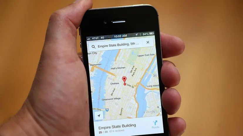
You are sitting in your car. The map shows a thick red line ahead. Or maybe it is green. You trust it. You trust that Google knows exactly how fast traffic is moving on a street you have never been to, at a time you have never traveled.
It feels like magic. It is not.
It is a mix of old-school sensors and a massive, global crowdsourcing network. The system relies on two distinct types of data. Historical averages. And real-time speed reports from your smartphone.
The Sensor Era
Before your phone had a GPS chip in its pocket, Google Maps looked at fixed infrastructure. It used data from traffic sensors.
These sensors are not in your car. They are embedded in the road or mounted on poles. Transportation agencies install them. Private companies place them too. They use radar. Active infrared. Laser technology.
The hardware detects two things. The size of the vehicle. The speed of the vehicle. That data travels wirelessly to a server.
This worked well for highways. It worked well for primary arteries. But it had a hard limit. Sensors were expensive to install. They were only placed on heavily traveled routes. Side streets? Ghost towns in the data. If the road was not busy enough to justify a sensor, Google Maps had no idea what was happening there.
“Sensor data was largely limited to highways and primary roads because the sensors were typically installed only on the most heavily traveled or traffic-prone routes.”
The Crowdsourcing Shift
Then came 2009.
Google changed the game. It stopped relying solely on hardware and started relying on humans. Or rather, the GPS chips in their pockets.
If you drive an Android phone with Google Maps open and location services enabled, your device is broadcasting data. Anonymously. Constantly.
Your phone reports its speed. Your phone reports its location. It sends this back to Google’s servers. Google combines these signals from thousands of cars. It calculates an average speed for that specific road segment.
If you are driving the speed limit, you blend into the green line. If you are crawling at 5 mph, you help paint the red line.
This solved the side-street problem. You do not need a sensor on a corner if you drive past it. Every driver is now a sensor.
When the Data Dries Up
What happens when there are no cars?
If Google Maps does not have enough data to estimate traffic flow for a specific section, the line turns gray. No green. No red. Just gray.
It means the algorithm has no confidence. It could be historical data, but it is not real-time. It is a guess based on what usually happens at 8 AM on a Tuesday.
The Human Element: Waze
Data from GPS is passive. It tells you how fast you are moving. It does not tell you why.
Why is traffic stopped on Main Street? Is there an accident? A broken-down truck? A speed trap?
In 2013, Google acquired Waze. This added a human reporting layer to the mix.
Waze users actively report incidents. Accidents. Construction. Disabled vehicles. Police speed traps. These appear as icons on the map. Small signs. Crashed car symbols. Camera icons.
This moves beyond simple speed. It explains congestion. It allows the algorithm to reroute you around a problem rather than just waiting for traffic to clear.
The FAQ Trap
Many people confuse the ecosystem. They ask about Google Earth. Or offline maps. Or Street View.
These are different tools.
You can access Google Earth on mobile and desktop without downloading the app. The Pro version requires a desktop download. All three versions are free.
Offline maps let you save an area while on Wi-Fi. You can get driving directions later without data.
Live View helps you navigate on foot. Open the app. Enter a destination. Tap Directions. Select Walking. Hit Live View. It uses your camera to overlay arrows on the real world.
Street View is just photos. Enter a destination. Look for the yellow guy icon. Click it. You see the street.
None of this calculates traffic. Traffic is the movement. The rest is just the view.
Why It Matters
The shift from sensors to smartphones changed how we move. We are no longer limited to major roads. The network is denser. More accurate.
But it requires participation. Your phone is working for the map. Your speed is data.
Does that make you uncomfortable? Maybe. Or maybe you just appreciate the green line.
The system works because it aggregates millions of individual experiences into a single truth. It smooths out your coffee stop. It ignores your detour. It finds the path of least resistance.
It is not perfect. The gray lines prove that. But for the most part, it knows where you are going. And it knows how long it will take.
You just have to follow the colors.